Công ty cổ phần công nghệ và tư vấn CIC
Specialized
Home > News > Specialized > Real-Time Landslide Monitoring: Lessons the Sichuan Rescue Operation
Construction Robots and Their Practical Value for Modern Construction Sites

KOMPAS-3D V24 Launches with Major Upgrades for Mechanical Design
5 Principles for Effective BIM Implementation in Vietnam
OpenFlows Water & Sewer 2026 – Bentley’s Powerful Software Duo

enjiCAD 2027 Officially Launched with Breakthrough Performance and an Enhanced Design Experience...
Nội dung chính
Real-Time Landslide Monitoring: Lessons the Sichuan Rescue Operation
29/07/2026
Lượt xem 13
In the era of climate change, extreme weather events such as prolonged heavy rainfall are increasing the frequency and scale of landslides, directly threatening human lives and technical infrastructure. To proactively prevent disasters and minimise damage, shifting passive response to intelligent monitoring, large-scale surveillance and early warning has become an inevitable trend. This innovative solution can be explored through the emergency rescue case study in Junlian, Sichuan.
1. Incident Background and the Challenges
- Incident: On February 8, 2025, a serious landslide occurred in Junlian County, Yibin City, Sichuan Province, China. A massive volume of soil and rock collapsed, causing severe damage.
- The greatest challenge: After a slope collapses, the most dangerous threat to rescue teams is the risk of a secondary landslide, in which the soil and rock mass continues to move. Ensuring the safety of search-and-rescue personnel was the highest priority.
2. CHCNAV’s Rapid Response
Immediately after the incident, CHC Navigation mobilised a rapid-response team comprising specialists Shanghai, Wuhan and Sichuan. The team arrived at the site on February 9 with the mission of establishing a 24/7 real-time deformation-monitoring system.
3. The Technology Ecosystem Deployed
To address this urgent challenge, CHCNAV simultaneously deployed two technology groups: comprehensive 3D surveying and detailed deformation monitoring.
Group 1: Ground-Based Radar Monitoring — Accurate and Continuous
- PS-2000 Radar System: This is a mobile ground-based synthetic aperture radar system. It was directed towards the slope to continuously scan and measure the movement of the landslide mass around the clock. SAR technology can operate through fog and rain and perform effectively at night, providing millimetre-level displacement accuracy.
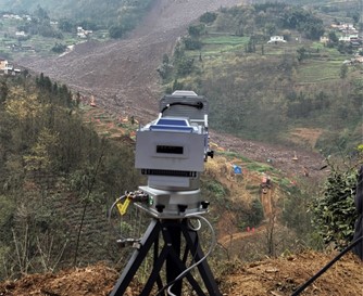
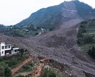
The PS2000 system was deployed to continuously monitor slope movement and stability.
At the monitoring and early-warning observation point, the team quickly deployed the PS2000 radar. The radar monitored the movement and stability of the entire landslide mass 24 hours a day, while the team continuously produced monitoring and slope-assessment reports. These reports provided the command centre with essential information for assessing the situation, planning rescue operations, protecting search-and-rescue personnel and preventing secondary disasters.
This is the core of slope stability monitoring: continuously taking remote measurements and converting ground movement into clear early-warning signals.
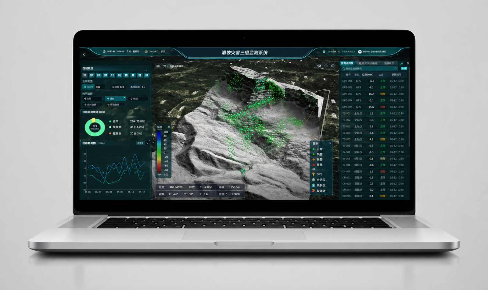
.jpg)
The monitoring software displays real-time displacement data collected by the ground-based PS2000 system, enabling continuous monitoring of slope movement across the entire landslide area.
Group 2: Aerial 3D Mapping — Comprehensive and Rapid
- X500 Multirotor UAV: A specialised unmanned aerial platform that acts as a workhorse, carrying advanced sensors around the disaster area.
- AlphaAir 10 (AA10) LiDAR: An ultra-lightweight LiDAR system that emits laser pulses towards the ground and penetrates vegetation canopies, creating high-density point clouds for the accurate modelling of disrupted terrain.
- C30 Oblique Camera: Captures high-resolution images to reconstruct a comprehensive, realistic 3D model of the area.
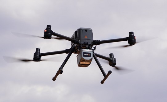
The X500 unmanned aerial vehicle equipped with the AA10 LiDAR system conducted an aerial survey to collect highly accurate terrain data for landslide analysis.
Using the elevation model, the team also generated slope-aspect and slope-gradient analysis maps. These maps provided the command centre with accurate data to assess the risk of secondary landslides and identify potentially unstable locations, allowing ground rescue teams to avoid the areas most vulnerable to further collapse.
.jpg)
Left: A Digital Elevation Model (DEM), reconstructed UAV LiDAR data covering approximately 3 km², provides detailed terrain information for risk assessment.
Right: Slope-gradient and slope-aspect maps generated the Digital Elevation Model help identify areas at risk of secondary landslides.
4. Implementation Results
- With only two flights, the UAV system carrying LiDAR and a camera completed the collection of high-density 3D point-cloud data for an area of approximately 3 km². This immediately gave the rescue command team a comprehensive view of the ground surface, fractures and slope structure.
Read more: CIC Introduces SLAM 3D Laser Surveying and UAV LiDAR Solutions to Coteccons Group
- At the same time, the PS-2000 radar continuously monitored the movement of soil and rock. The system immediately issued an alert whenever abnormal displacement was detected.
5. Lessons Learned
The Junlian case study in Sichuan shows that modern disaster prevention and response increasingly depend on advanced technologies:
- Speed is essential: In rescue operations, the ability to arrive at the scene and deploy a complex monitoring system within one day demonstrates the mobility of modern equipment, particularly drones and mobile radar.
- Protecting the rescuers: Instead of sending personnel onto dangerous mountain slopes to install markers and conduct manual measurements, non-contact remote-monitoring technologies such as UAVs and radar performed these tasks much more safely and accurately.
- Data integration: The combination of static geospatial data—3D LiDAR maps used for rescue planning—and dynamic data—24/7 radar monitoring used to issue evacuation warnings when further slope failure is imminent—provides a comprehensive basis for rescue operations.
For further information, please contact:
CIC Construction Technology and Consultancy Joint Stock Company
Hotline: 0976 268 036 / 024 3974 1373