PLAXIS 3D | Giải pháp phần mềm 3D phần tử hữu hạn trong lĩnh vực địa kỹ thuật

PLAXIS 3D
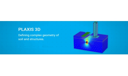
PLAXIS 3D - Phần mềm phân tích địa kỹ thuật và nền móng 3D
Giá: Liên hệLiên hệ sản phẩm
Đăng ký mua
.JPG)

Các modules mở rộng
PLAXIS 3D PlaxFlow: 3D PlaxFlow is an add-on module to PLAXIS 3D. Groundwater flow is an important issue in many engineering fields such as geotechnical, environmental and hydrological engineering. In order to take groundwater flow into ac in geotechnical software applications, advanced models for the simulation of the unsaturated, time-dependent and anisotropic behaviour of soil are required.
PLAXIS 3D Dynamis: 3D Dynamics is an add-on module to PLAXIS 3D. Soil and structures are often not only subjected to static loads due to construction in and on the ground surface but also to dynamic loads. When loads are powerful, like for example earthquakes, they may cause severe damages. Vibrations may occur either man-made or natural. In urban areas, vibrations can be generated due to pile driving, vehicle movement, heavy machinery or train travel. The source of natural vibrations in the subsoil is earthquakes. With the Dynamics module PLAXIS can analyse the effects of vibrations in the soil.
Modelling
- Elastoplasticity for beams and plates
- Revolve around axis tool (VIP)
- CAD export (VIP)
- Non-linear geogrids: Elastoplastic (N-ε)&Viscoelastic (time-dependent)
- Cross and parallel permeability in interfaces
- Polar & rectangular array (VIP)
- Easy definition of Rock bolts in Tunnel Designer (VIP)
- Define excavation sequence in the tunnel designer (VIP)
- Automatic generation of staged construction phases for tunnels (VIP)
Material Models
- UBCSand (VIP)
- User Defined Soil Models (VIP)
- Soft Soil (with and without creep)
- Sekiguchi-Ohta, Viscid & Inviscid (VIP)
- NGI-ADP model (VIP)
- Jointed Rock
- Hoek-Brown with Parameter Guide (VIP)
- HS Small strain stiffness
- Hardening Soil
Calculations 
- Field stress initial calculation type (VIP)
- Full 64-bit Software
- Well-proven and robust calculation procedures
- Pseudo-static analysis
- Plastic calculation, consolidation analysis and safety analysis
- Multicore computing (VIP)
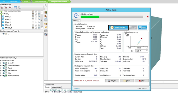
- Facilities for steady-state groundwater flow calculations, including flow-related material parameters, boundary conditions, drains and wells.
- Convenient and intuitive Phase explorer
- Automatic regeneration of construction stages for geometric changes
Results
-
Change the number of significant digits shown
-
Structural forces cylindrical and square volume piles
-
Realistic assessment of stresses and displacements
-
Output Model Explorer
-
Movable cross-sections
-
Extensive report and movie Generator
-
Contour, shading, iso-surface and vectors plots
-
Advanced data slicing
Fast and efficient finite element model creation.png)
The user-friendly interface guides the user to efficiently create models with a logical geotechnical workflow. Via Boreholes users can define complex soil profiles or geological cross-sections. In the Structures mode, structural elements, like piles, anchors, geotextiles, and prescribed loads and displacements can be defined. Geometry can also be imported from CAD-files. The automatic meshing procedure creates a With Staged Construction users can accurately model the construction process, by activating and deactivating soil clusters and structural elements in each calculation phase. With plastic, consolidation and safety analysis calculation type, a broad range of geotechnical problems can be analyzed. Constitutive models range from simple linear to advanced highly non-linear models wide range of soil and rock behaviour can be simulated. Well proven and robust calculation procedures ensure converging calculations and accurate results. With multi-core calculations and 64-bit architecture PLAXIS can deal with the largest and most complex models.finite element mesh almost immediately.
Realistic assessment of stresses and displacements
With Staged Construction users can accurately model the construction process, by activating and deactivating soil clusters and structural elements in each calculation phase. With plastic, consolidation and safety analysis calculation type, a broad range of geotechnical problems can be analyzed. Constitutive models range from simple linear to advanced highly non-linear models wide range of soil and rock behaviour can be simulated. Well proven and robust calculation procedures ensure converging calculations and accurate results. With multi-core calculations and 64-bit architecture PLAXIS can deal with the largest and most compl
Powerful and versatile post processing
The versatile Output program offers various ways to display forces, displacements, stresses, and flow data in contour, vector and iso-surface plots. Cross-section tools allow more detailed analysis of results. Data can be copied from tables or via Python based scripting for further processing purposes outside of PLAXIS. The Curve manager enables graph creation, plotting various results types from available calculation data.ex models.
Mô hình
- Change the number of significant digits shown
- Structural forces from cylindrical volume piles
- Realistic assessment of stresses and displacements
- Output Model Explorer
- Movable cross-sections
- Extensive report and movie Generator
- Contour, shading, iso-surface and vectors plots
- Advanced data slicing
Thiết kế
- User Defined Soil Models (VIP)
- Soft Soil creep
- Soft soil
- Sekiguchi-Ohta, Viscid & Inviscid (VIP)
- NGI-ADP model (VIP)
- Mohr-Coulomb
- Modified Cam Clay
- Jointed Rock
- HS Small strain stiffness
Tính toán
- Reduce required project disk space by changing the saved step interval
- New initial phase calculation type: Field Stress (VIP)
- Full 64-bit release with performance improvements
- Well-proven and robust calculation procedures
- Pseudo-static analysis
- Plastic calculation, consolidation analysis and safety analysis
- Multicore computing (VIP)
- Facilities for steady-state groundwater flow calculations, including flow-related material parameters, boundary conditions, drains and wells.
- Convenient and intuitive Phase explorer
Xuất kết quả
- Design of stable stope panels and pillars
- Wellbore stability analysis
- Stress changes and surface settlement due to reservoir depletion
- Trim and Extend functionality
- Python integration in Expert Menu (VIP)
- Polar Array (VIP)
- New Embedded beam behavior type: Grout Body
- More control over visualization of local axes
- Improved Import (VIP)
Chưa có tài liệu
Sản phẩm liên quan
PLAXIS 2D Phần mềm phân tích địa kỹ thuật...
Giá: Liên hệ
PLAXIS 2D Giải pháp phần mềm 2D phần tư hữu hạn ứng dụng trong...
Liên hệ sản phẩm
Đăng ký mua
Download

OILMAP DEEP Giải pháp dầu tràn ở trên bề...
Giá: Liên hệ
OILMAPDEEP là phần mềm cung cấp những phán đoán nhanh chóng của sự di chuyển...
Liên hệ sản phẩm
Đăng ký mua
PLAXIS VIP Gói bảo trì, cập nhật phần mềm...
Giá: Liên hệ
Plaxis VIP là một hệ thống đăng ký bổ sung dựa trên bản quyền truyền...
Liên hệ sản phẩm
Đăng ký mua
PLAXIS MoDeTo - Phần mềm thiết kế cọc monopie
Giá: Liên hệ
PLAXIS MoDeTo Dòng sản phẩm mới của PLAXIS ứng dụng thiết kế cọc monopile...
Liên hệ sản phẩm
Đăng ký mua
Download

GeoStudio Gói phần mềm phân tích ổn định mái...
Giá: Liên hệ
GeoStudio gói phần mềm mô hình hóa địa kỹ thuật dành cho các kỹ sư,...
Liên hệ sản phẩm
Đăng ký mua

GEO5 - Phần mềm phân tích địa kỹ thuật
Giá: Liên hệ
GEO5 là một bộ phần mềm, cung cấp giải pháp cho hầu hết các vấn đề...
Liên hệ sản phẩm
Đăng ký mua

TALREN Phần mềm phân tính, thiết kế ổn định...
Giá: Liên hệ
CÔNG TY CỔ PHẦN CÔNG NGHỆ VÀ TƯ VẤN CIC
Trụ sở chính:
Số 37 Lê Đại Hành, P. Hai Bà Trưng, TP. Hà Nội
Điện thoại: 086 893 4576
- 024 3976 1381
Email:
info@cic.com.vn
Website:
https://www.cic.com.vn
Chi nhánh Tp HCM:
Số 36 Nguyễn Huy Lượng, P. Bình Thạnh, TP. Hồ Chí Minh
Điện thoại:
088 645 2020 - 028 628 99022 - 028 628 99033
Email:
cichcm@cic.com.vn
Sản phẩm
Dịch vụ
Kết nối facebook
© Bản quyền thuộc Công ty Cổ phần Công nghệ và Tư vấn CIC | Chính sách sử dụng và bảo mật thông tin


